Distance Calculator

Autovía de Sevilla a Almería por Granada, Carretera de Arcos de la Frontera a Antequera

587.9 km, 7 h 11 min

Head west on carrer Forn de la Vila35 m
Turn right onto carrer Major de la Vila100 m
Turn left onto Pont d'Altamira150 m
Continue onto carrer Vicente Blasco Ibáñez700 m
Continue onto Avinguda de la Llibertat (N-340)1 km
Enter Rotonda de l'Aljub and take the 2nd exit onto Avinguda de Crevillent (N-340)70 m
Exit the traffic circle onto Avinguda de Crevillent (N-340)500 m
Keep left onto Carretera Elx - Crevillent (N-340)1.5 km
Enter the traffic circle and take the 2nd exit onto Carretera Elx - Crevillent (N-340)70 m
Exit the traffic circle onto Carretera Elx - Crevillent (N-340)1 km
Enter the traffic circle and take the 2nd exit onto Carretera Elx - Crevillent (N-340)70 m
Exit the traffic circle onto Carretera Elx - Crevillent (N-340)450 m
Take the ramp200 m
Keep left at the fork700 m
Keep left at the fork450 m
Merge left onto Autovia de la Mediterrània (A-7)4.5 km
Keep left towards Murcia10 km
Continue onto Autovía del Mediterráneo (A-7)30 km
Continue onto A-302.5 km
Keep right towards A-7: Alcantarilla - Almería - Granada800 m
Continue onto A-780 km
Take the ramp towards A-91: Velez Rubio15 km
Continue onto Autovía de Guadix a Límite de Región de Murcia (A-92N)100 km
Merge left onto Autovía de Sevilla a Almería por Granada (A-92)100 km
Keep left towards Córdoba30 km
Take the ramp towards Campillos1.5 km
Continue onto Carretera de Arcos de la Frontera a Antequera (A-384)25 km
Continue onto Carretera de Antequera (A-384)400 m
Continue onto Avenida Sierra de Yeguas (A-384)350 m
Keep left onto Carretera de Arcos de la Frontera a Antequera (A-384)1.5 km
Enter the traffic circle and take the 2nd exit onto Carretera de Arcos de la Frontera a Antequera (A-384)45 m
Exit the traffic circle onto Carretera de Arcos de la Frontera a Antequera (A-384)55 km
Keep right onto Carretera de Arcos de la Frontera a Antequera (A-384)45 km
Take the ramp600 m
Continue onto Autovía de Jerez de la Frontera a Arcos de la Frontera (A-382)25 km
Continue onto Carretera de Acceso a Jerez desde la A-382 (A-2005)1 km
Enter the traffic circle and take the 1st exit4 m
Exit the traffic circle200 m
Turn left onto A-4R15 m
Turn left to stay on A-4R450 m
Keep left onto A-4R400 m
Make a slight right25 m
Enter Rotonda Michelín and take the 2nd exit onto Avenida la Granja80 m
Exit the traffic circle onto Avenida la Granja400 m
Enter the traffic circle and take the 2nd exit onto Avenida la Granja25 m
Exit the traffic circle onto Avenida la Granja450 m
Enter the traffic circle and take the 2nd exit onto Avenida de Europa55 m
Exit the traffic circle onto Avenida de Europa800 m
Enter the traffic circle and take the 1st exit onto Avenida de Europa10 m
Exit the traffic circle onto Avenida de Europa350 m
Enter the traffic circle and take the 2nd exit onto Avenida de la Feria55 m
Exit the traffic circle onto Avenida de la Feria400 m
Enter Plaza de Rosaleda and take the 2nd exit onto Calle Rafael Alberti60 m
Exit the traffic circle onto Calle Rafael Alberti550 m
Enter Glorieta Manuel Simó de la Riva and take the 3rd exit onto Avenida Nuestra Señora de la Paz60 m
Exit the traffic circle onto Avenida Nuestra Señora de la Paz300 m
Continue straight to stay on Avenida Nuestra Señora de la Paz200 m
Go straight onto Calle Arcos55 m
Turn left onto Calle María Antonia de Jesús Tirado350 m
Turn right onto Calle Medina80 m
Turn left onto Calle Santa Rafaela María100 m
Turn right onto Plaza las Angustias70 m
Go straight onto Calle Granados100 m
Turn left onto Calle Sol8 m
Turn right onto Calle Cazón100 m
Turn right onto Calle Empedrada150 m
Continue onto Calle Barja300 m
Turn right onto Calle San Agustín25 m
Enter the traffic circle and take the 2nd exit onto Calle Conde de Bayona40 m
Exit the traffic circle onto Calle Conde de Bayona50 m
Turn right onto Calle Armas100 m
You have arrived at your destination, straight ahead0 m

Autovía del Mediterráneo, Autovía de Sevilla a Almería por Granada

670.7 km, 7 h 38 min

Head west on carrer Forn de la Vila35 m
Turn right onto carrer Major de la Vila100 m
Turn left onto Pont d'Altamira150 m
Continue onto carrer Vicente Blasco Ibáñez700 m
Continue onto Avinguda de la Llibertat (N-340)1 km
Enter Rotonda de l'Aljub and take the 2nd exit onto Avinguda de Crevillent (N-340)70 m
Exit the traffic circle onto Avinguda de Crevillent (N-340)500 m
Keep left onto Carretera Elx - Crevillent (N-340)1.5 km
Enter the traffic circle and take the 2nd exit onto Carretera Elx - Crevillent (N-340)70 m
Exit the traffic circle onto Carretera Elx - Crevillent (N-340)1 km
Enter the traffic circle and take the 2nd exit onto Carretera Elx - Crevillent (N-340)70 m
Exit the traffic circle onto Carretera Elx - Crevillent (N-340)450 m
Take the ramp200 m
Keep left at the fork700 m
Keep left at the fork450 m
Merge left onto Autovia de la Mediterrània (A-7)4.5 km
Keep left towards Murcia10 km
Continue onto Autovía del Mediterráneo (A-7)30 km
Continue onto A-302.5 km
Keep right towards A-7: Alcantarilla - Almería - Granada800 m
Continue onto A-780 km
Take the ramp towards A-91: Velez Rubio15 km
Continue onto Autovía de Guadix a Límite de Región de Murcia (A-92N)100 km
Merge left onto Autovía de Sevilla a Almería por Granada (A-92)100 km
Keep right towards Málaga25 km
Merge right onto Autovía de Málaga (A-45)1.5 km
Keep left towards AP-467 km
Merge right onto Autopista de las Pedrizas (AP-46)20 km
Keep right onto AP-46150 m
Keep left towards E-15: Torremolinos1.5 km
Merge left onto Autovía del Mediterráneo (A-7)25 km
Keep left onto Autopista del Mediterráneo (AP-7)15 km
Take the ramp towards Telepeaje150 m
Keep left at the fork250 m
Merge left onto Autopista del Mediterráneo (AP-7)15 km
Continue onto Autovía/Autopista del Mediterráneo (A-7/AP-7)5 km
Keep left at the fork350 m
Continue onto Autopista del Mediterráneo (AP-7)8 km
Take the ramp onto AP-7100 m
Keep left onto AP-7300 m
Merge left onto Autopista del Mediterráneo (AP-7)15 km
Continue onto Autovía/Autopista del Mediterráneo (A-7/AP-7)2 km
Continue onto Autopista del Mediterráneo (AP-7)10 km
Take the ramp on the left70 m
Merge right onto Autopista del Mediterráneo (AP-7)10 km
Continue onto Autovía del Mediterráneo (A-7)20 km
Take exit 1115 A towards A-381: Los Barrios800 m
Continue onto Autovía Jerez-Los Barrios (A-381)90 km
Continue onto Carretera de Acceso a Jerez desde la A-381 (A-2004)450 m
Enter the traffic circle and take the 1st exit onto Carretera de Acceso a Jerez desde la A-381 (A-2004)45 m
Exit the traffic circle onto Carretera de Acceso a Jerez desde la A-381 (A-2004)1 km
Enter the traffic circle and take the 1st exit onto Avenida de Medina Sidonia (A-2004)30 m
Exit the traffic circle onto Avenida de Medina Sidonia (A-2004)1.5 km
Enter the traffic circle and take the 2nd exit onto Avenida de Medina Sidonia (A-2004)40 m
Exit the traffic circle onto Avenida de Medina Sidonia (A-2004)900 m
Enter the traffic circle and take the 3rd exit onto Calle Obispo Cirarda150 m
Exit the traffic circle onto Calle Obispo Cirarda100 m
Enter the traffic circle and take the 1st exit onto Calle Obispo Cirarda8 m
Exit the traffic circle onto Calle Obispo Cirarda600 m
Continue onto Calle Puerta del Sol200 m
Continue slightly left onto Calle Empedrada500 m
Continue onto Calle Barja300 m
Turn right onto Calle San Agustín25 m
Enter the traffic circle and take the 2nd exit onto Calle Conde de Bayona40 m
Exit the traffic circle onto Calle Conde de Bayona50 m
Turn right onto Calle Armas100 m
You have arrived at your destination, straight ahead0 m
From
    To

      Distance: 317.68 mi (511.26 km)

      Driving route: 365.31 mi (587.90 km).

      Driving time: 7h 10 min

      Distance from Jerez de la Frontera to Elche

      The shortest distance (air line) between Jerez de la Frontera and Elche is 317.68mi (511.26 km)

      The shortest route between Jerez de la Frontera and Elche is 365.31 mi (587.90 km) according to the route planner. The driving time is approx. 7 h 10 m

      How far is it between Jerez de la Frontera and Elche.

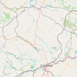
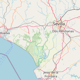
      Jerez de la Frontera is located in Cádiz, Spaincountry within 36° 40' 54.12" N -7° 51' 43.92" W (36.6817, -6.1378) coordinates. The local time in Jerez de la Frontera is 19:02 (18.03.2025)

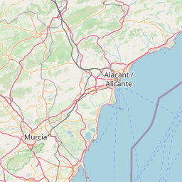
      Elche is located in Alicante/Alacant, Spaincountry within 38° 16' 0.84" N -1° 18' 6.12" W (38.2669, -0.6983) coordinates. The local time in Elche is 19:02 (18.03.2025)

      The calculated flying distance from Jerez de la Frontera to Elche is 317.68miles which is equal to 511.26 km.

      If you want to go by car, the driving driving distance between Jerez de la Frontera and Elche is 365.31 miles (587.90 km). If you ride your car with an average speef of 112 kilometers/hour (70 miles/h), travel time will be 5 hours 15 minutes.Please check the avg.speed travel time on the right for various options

      Estimated Travel Time Between Jerez de la Frontera and Elche

      Average speedTravel Time
      30 mph (48 km/h)12 hours 11 minutes
      40 mph (64 km/h)9 hours 8 minutes
      50 mph (80 km/h)7 hours 18 minutes
      60 mph (67 km/h)6 hours 5 minutes
      70 mph (112 km/h)5 hours 13 minutes
      75 mph (120 km/h)4 hours 52 minutes

      Jerez de la Frontera, Cádiz, Spain

      Related Distances from Jerez de la Frontera

      CitiesDistance
      Jerez de la Frontera to Las Palmas801.17 mi (1,289.36 km)
      Jerez de la Frontera to Sevilla39.43 mi (63.45 km)
      Jerez de la Frontera to Malaga95.20 mi (153.20 km)
      Jerez de la Frontera to Cordoba111.72 mi (179.79 km)
      Jerez de la Frontera to Granada144.25 mi (232.15 km)
      Jerez de la Frontera to Mostoles280.57 mi (451.53 km)
      Jerez de la Frontera to Murcia289.44 mi (465.81 km)
      Jerez de la Frontera to Madrid289.64 mi (466.13 km)
      Jerez de la Frontera to Cartagena290.94 mi (468.22 km)
      Jerez de la Frontera to Petrel317.66 mi (511.23 km)
      Jerez de la Frontera to Elche317.68 mi (511.26 km)
      Jerez de la Frontera to Alicante330.47 mi (531.83 km)
      Jerez de la Frontera to Valladolid351.71 mi (566.02 km)
      Jerez de la Frontera to Valencia367.73 mi (591.80 km)
      Jerez de la Frontera to Vigo407.25 mi (655.40 km)
      Jerez de la Frontera to Zaragoza443.73 mi (714.12 km)
      Jerez de la Frontera to Oviedo461.68 mi (743.01 km)
      Jerez de la Frontera to Vitoria-Gasteiz463.89 mi (746.56 km)
      Jerez de la Frontera to Gijon473.96 mi (762.77 km)
      Jerez de la Frontera to Bilbao485.03 mi (780.58 km)
      Jerez de la Frontera to Palma517.28 mi (832.48 km)
      Jerez de la Frontera to Tarrasa551.22 mi (887.11 km)
      Jerez de la Frontera to Barcelona551.51 mi (887.58 km)
      Jerez de la Frontera to Sabadell554.94 mi (893.09 km)
      Jerez de la Frontera to Badalona555.89 mi (894.61 km)

      Elche, Alicante/Alacant, Spain

      Related Distances to Elche

      CitiesDistance
      Las Palmas to Elche1,100.40 mi (1,770.92 km)
      Alicante to Elche12.86 mi (20.70 km)
      Petrel to Elche15.59 mi (25.09 km)
      Murcia to Elche30.46 mi (49.02 km)
      Cartagena to Elche48.60 mi (78.22 km)
      Valencia to Elche84.91 mi (136.65 km)
      Granada to Elche175.55 mi (282.52 km)
      Palma to Elche201.14 mi (323.71 km)
      Madrid to Elche218.72 mi (352.00 km)
      Mostoles to Elche221.52 mi (356.50 km)
      Cordoba to Elche223.53 mi (359.74 km)
      Malaga to Elche230.32 mi (370.66 km)
      Zaragoza to Elche233.95 mi (376.51 km)
      Barcelona to Elche263.81 mi (424.57 km)
      Badalona to Elche268.37 mi (431.90 km)
      Tarrasa to Elche268.99 mi (432.90 km)
      Sabadell to Elche271.10 mi (436.30 km)
      Sevilla to Elche297.61 mi (478.96 km)
      Valladolid to Elche316.43 mi (509.24 km)
      Jerez de la Frontera to Elche317.68 mi (511.26 km)
      Vitoria-Gasteiz to Elche333.34 mi (536.45 km)
      Bilbao to Elche363.87 mi (585.60 km)
      Oviedo to Elche442.82 mi (712.65 km)
      Gijon to Elche447.73 mi (720.55 km)
      Vigo to Elche503.29 mi (809.96 km)